
Trace a Fall River Street Address
A Fall River street directory search is a chain, not a list of households. Begin with the physical address in the assessor portal, save the parcel ID and owner name, and then use MUGIS to place the parcel on its street. The Registry connects a named owner to a transfer and legal description. Voter and directory material can offer a separate registered-person or historical household clue. Each layer has a different date and purpose, so the result is stronger when two layers agree.
- Search the street number and name in Patriot Properties, then save the situs and parcel ID.
- Open the parcel in Fall River MUGIS to inspect its map position and nearby parcels.
- Search the recorded-land index for the current owner as grantee, then record the deed’s grantor, date, book/page, and legal description.
- Use public voter access only as the limited registration layer allowed by Massachusetts law.
- For prior decades, browse the local address entries in directories, newspapers, census, and map collections.
Ownership is not the same as occupancy. A trust, estate, company, or absentee owner can appear on a parcel card. A voter record is also narrower than a household. The street-by-street method preserves those differences instead of turning an address match into a claim about every person who may live there.
Search Fall River Streets in Patriot
The City of Fall River Assessor uses Patriot Properties as its public property-search portal. Street name with number, parcel ID, and owner name are the three observed routes. A returned property card may supply owners, location, land area, land-use classification, building or improvement area, values, construction features, and narrative detail. The counter-list example is a field guide, not a promise that every live result contains every value.
| Search field | Type | Verified note |
|---|---|---|
| Street name | Address search | Use with street number to find the situs parcel. |
| Street number | Address search | Pair with the street name; historical numbers may differ. |
| Parcel ID | Property key | Best precise key for repeating a parcel search. |
| Owner name | Name search | Find assessed ownership records and spelling variants. |
Keep situs and mailing address in separate notes. Situs means the physical parcel location. A mailing address is tax correspondence and may belong to a representative or be outside the city. The city’s assessment values can also lag a recent conveyance, which is why a Fall River street directory trail checks the Registry when ownership timing matters.
Map Fall River Street Parcels
MUGIS supplies the street-level map context missing from a parcel card. Select a parcel or use New Parcel Selection, enter a buffer length and unit, click Buffer, and inspect parcels in the selected area. The viewer can show parcel geometry, roads, zoning or district context, and a property-tax or assessment panel. A buffer is a map radius, not a legal boundary, so unusual lines should be confirmed with a deed or plan.
Use the Fall River MUGIS viewer for the map layer.
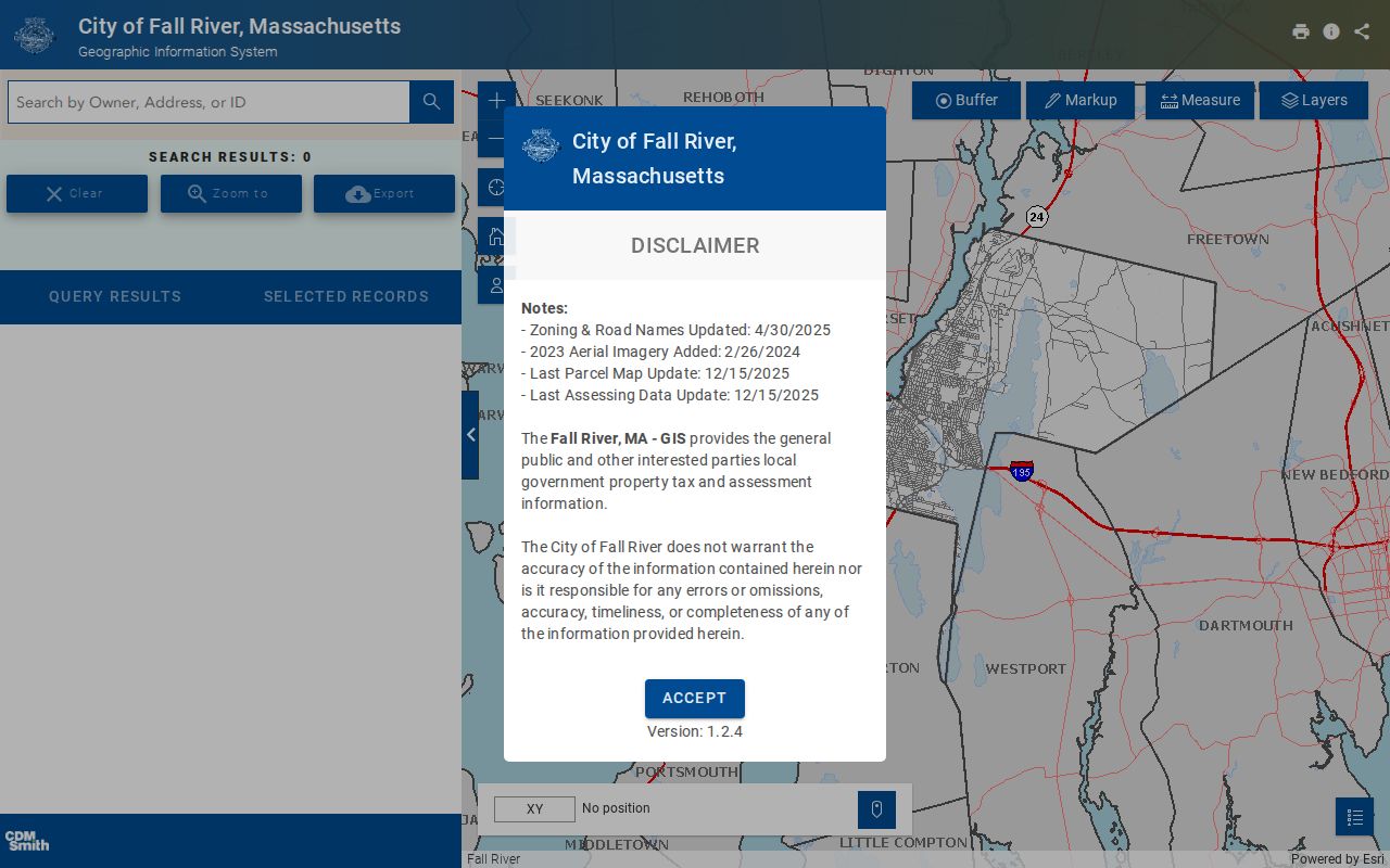
MUGIS helps organize the parcels along a street before the assessor and Registry supply their separate record details.
Its observed update notices include roads and zoning, aerial imagery, and parcel-assessing layers from different dates. Read the viewer’s disclaimer before assuming any map feature is current.
Fall River Records by Street
Address-keyed Fall River records answer different parts of a street question. The assessor card identifies a current assessed owner and parcel characteristics. MUGIS plots the parcel. A Registry deed documents a transfer and legal description. A local voter list can provide a limited registration record, while the annual municipal census has a broader household scope but is accessed by request. Permits can date work at a property when released, but no complete public historical permit-result archive was located.
| Street record | Local keeper | Useful result | Access boundary |
|---|---|---|---|
| Parcel record | Fall River Assessor | Owner, situs, parcel details | Public portal; not all occupants |
| Parcel map | Fall River MUGIS | Geometry, nearby parcels, map context | Viewer disclaimer; no ZIP filter observed |
| Recorded deed | District Registry | Transfer parties, book/page, legal description | Not a current-occupant record |
| Voter record | Elections | Permitted registration fields | Protected fields and people withheld |
| Permit or code record | Inspectional Services | Work or case chronology where releasable | Search archive not established |
| Directory entry | Library / archive | Dated address and household lead | Gaps, OCR, abbreviations |
Parcel ID joins the Assessor and MUGIS layers. Book/page, plan, and legal description join the property record to land evidence. A street name is useful, but it changes more easily than the land identifiers.
Follow Fall River Deeds Along a Street
The Fall River District Registry of Deeds indexes recorded and registered land for Fall River, Freetown, Somerset, and Swansea. A street search should keep the town selected when possible. The dependable chain begins with the assessed owner, then searches that owner as grantee around the likely purchase date. The purchase deed identifies the seller, and the seller can be searched as an earlier grantee. Repeat while saving each legal description and plan reference.
The land-record search portal offers free searching and watermarked image viewing. Online printing or downloading is $1 per page. The observed online certified name range begins in 1947 even though images are available from Book 1 and the Registry’s office history reaches 1883. A blank older name search calls for book/page work, office assistance, or archive support, not a conclusion that no deed exists.
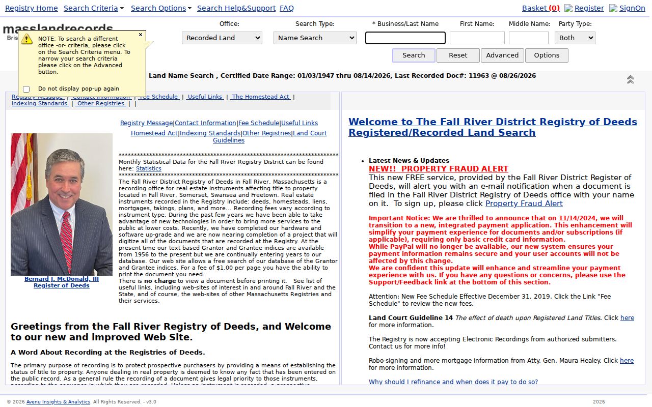
The Registry index is a transfer trail. It should be read with the parcel record instead of being treated as a list of present street residents.
Read Fall River Address Keys
Several terms make a street directory search more accurate. A parcel is the assessed unit of land. Situs is its physical address. A plat or plan is a mapped land reference. A criss-cross directory is an address-oriented directory that can point from a street number toward a past household. Fall River did not yield a separately titled official reverse-directory run, but the city directories and their digital browse/search interface perform the local address-to-occupant role.
- Parcel ID
- The city property key used to identify one assessed tract.
- Situs address
- The physical parcel location, distinct from tax correspondence.
- Legal description
- The deed or plan language that identifies land across address changes.
- Criss-cross directory
- An address-oriented directory method for locating a historical household entry.
These keys matter because an address is not permanent. Fall River history records a 1875 change in which 66 Second Street became 92 Second Street. A historical search should retain both numbers, inspect nearby entries and maps, and compare the deed’s legal description. Earlier sources can also use Troy, the city’s former name from 1804 to 1834.
Use Fall River Voter Records Carefully
A local public voter record may include name, residence address, party, date of birth, active or inactive status, and voter ID under Massachusetts rules. It does not disclose phone or email, and confidential voters, minors, and other protected categories are not ordinary public-list results. The statewide voter file is not available for unrestricted public download. Request only the relevant local record or field set through the proper election channel.
Fall River’s municipal census is a separate record. It can include all listed people in a household, including children, but its access must be evaluated under the public-records rules and privacy restrictions. Neither a voter match nor a non-match proves current physical presence. Pair a dated registration lead with a parcel, deed, directory, court filing, or other independent official record.
Date Fall River Street Work
Building, Engineering, and Planning launched on Fall River’s OpenGov platform in November 2023. A public permit result, when available, can link an address to an applicant or owner, work description, issue or close date, fee, and inspection status. It is evidence of an event at a property, not a household list. Research did not establish a full searchable public archive for prior permits or code cases.
Use the Fall River OpenGov portal where a live address search is available. Otherwise, send Inspectional Services a narrow request for an address and date range. Compare a permit date with deed, assessment, and map evidence before inferring a building change or ownership transition.
Browse Fall River Street History
The Fall River Public Library’s local-history service has city directories on microfilm for 1853 through 1967 and later print runs, while the Community History Archive digitizes city directories through 2021. For an old address, browse the street heading and nearby entries rather than relying only on optical-character recognition. The entry can provide a head-of-household or business lead, yet it is not proof of deed title or every person in the home.
The Historic Society, library newspapers, census microfilm, Sanborn maps, and valuation books help bridge a gap. Those collections are best used after the current parcel and legal description have been saved. The full run and entry-reading method are available in the Fall River city directory collections.
Limits of a Fall River Street Directory
A Fall River street directory cannot provide a complete, current list of people in homes along a road. Utility customer names and accounts are not a public household source. RMV personal data is restricted by DPPA. Public voter fields exclude protected categories, and a registered voter is not every occupant. An assessor mailing address is not proof that an owner lives at the situs. A map buffer also does not establish a legal boundary or a personal relationship between nearby owners.
Massachusetts protects confidential voter registration through M.G.L. c.51 §51A and offers address protection through the Safe at Home program. Court files can be sealed or impounded, and recent vital records have statutory restrictions. The correct response to an unclear result is to verify with the custodian, not to seek protected fields through a different channel.
Lawful use. Fall River street records support personal, family-history, property, and civic research. Do not use an address or name to stalk, harass, intimidate, or harm anyone.